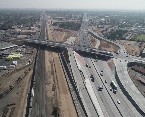
 https://summitenvcon.com/wp-content/uploads/2024/05/Looking-south-over-the-successfully-completed-Highway-99-Realignment-Project.jpg
720
1280
Summit Environmental Contractors
https://summitenvcon.com/wp-content/uploads/2023/03/Untitled-design20-300x90.png
Summit Environmental Contractors2024-05-08 17:21:322024-05-22 19:12:02Construction on State Highway – Merced, CA
https://summitenvcon.com/wp-content/uploads/2024/05/Looking-south-over-the-successfully-completed-Highway-99-Realignment-Project.jpg
720
1280
Summit Environmental Contractors
https://summitenvcon.com/wp-content/uploads/2023/03/Untitled-design20-300x90.png
Summit Environmental Contractors2024-05-08 17:21:322024-05-22 19:12:02Construction on State Highway – Merced, CAGIS is a cutting-edge technology that utilizes low-altitude aerial photography and modeling for an extensive range of applications, with a particular focus on geological, hydrological, and environmental aspects. Summit Environmental has joined forces with Earth Forensics to deliver an array of drone and 3D modeling services catering to these specialized needs. The collaboration offers the following services:
- Landslides and Slope Stability
- Environmental Photography
- Commercial, Industrial, and Residential Site Reconnaissance
- Contamination, Fault Delineation, and Mapping
- Volumetric Calculation
- 3D Modeling of Job Site
Geographic Information Systems (GIS)
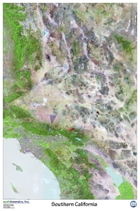
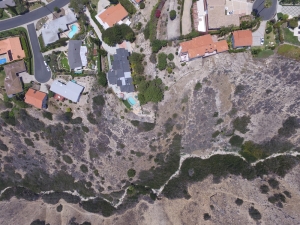
GIS Services: Geographic Information Systems (GIS) use advanced technology to capture, analyze, and visualize spatial data for diverse applications. Summit Environmental, in collaboration with Earth Forensics, offers a comprehensive suite of GIS services tailored to meet our clients’ specific needs. Our expertise enables informed decision-making and effective project management.
Core GIS Services:
- Landslide Hazard and Slope Stability Analysis: Detailed geotechnical monitoring and stability assessments to mitigate landslide risks.
- Aerial and Satellite Imagery Acquisition: High-resolution imagery for environmental monitoring and assessments.
- Site Characterization and Reconnaissance: Performing comprehensive site investigations for commercial, industrial, and residential developments.
- Contaminant Mapping: Accurately identifying and mapping concentration of contaminants.
- Geological Fault Mapping: Detailed and thorough mapping of faults.
- Volumetric Analysis: Accurate measurement and analysis of materials.
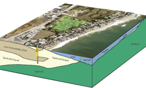
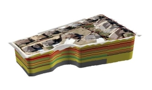
- Terrain and Site Modeling: High-fidelity 3D models of project sites for detailed spatial analysis.
- Urban Planning and Land Development: 3D city models, multi-hazard risk assessments, utility network optimization, land use planning.
- Natural Resource Exploration and Management: Geological and geophysical analyses, field production measurement, subsurface and surface data visualization, and resource extraction management.
3-D Modeling
3-D Modeling Services: Summit Environmental enhances planning, analysis, and communication by creating highly detailed 3D models. Our modeling services support applications in architecture, environmental monitoring, site analysis, and heritage preservation.
Core 3D Modeling Services:
- Architectural Visualization: Developing detailed models of buildings and interiors for design and presentation purposes.
- Environmental and Site Modeling: Creating accurate 3D representations for monitoring and analyzing environmental changes.
- Volumetric Analysis: Performing calculations for excavation, material management, and resource estimation.
- Infrastructure and Utility Modeling: Modeling utility networks and infrastructure projects to support planning and maintenance.
- Virtual Prototyping and Simulation: Assessing design performance using virtual models.
- Heritage and Archaeological Preservation: Utilizing 3D scanning and reconstruction to preserve and study historical sites.
Aerial Forensics: Specializing in low-altitude aerial photography and modeling, our aerial forensics services support geological, hydrological, environmental, and litigation needs. Utilizing state-of-the-art drone technology, we capture detailed aerial images and data for comprehensive analysis and documentation.
Applications of Aerial Forensics:
- Landslide and Slope Stability Documentation: Capturing detailed imagery to assess and document landslide risks and slope stability.
- Site Reconnaissance: Conducting aerial inspections for various commercial, industrial, and residential developments.
- Environmental Photography and Monitoring: Monitoring environmental conditions or site progress through high-resolution aerial imagery.
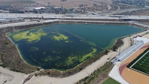
- Detention Basin Monitoring: Inspecting and documenting the condition and performance of detention basins.
- Contamination and Fault Delineation: Identifying and mapping environmental contamination and faults.
- Volumetric Calculations and 3D Modeling: Accurate modeling and volumetric assessments from aerial data.
Equipment Used:
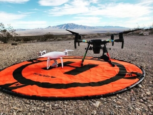
- Drones: DJI Matrice 210, Phantom 4 Pro, Spark, Phantom 3 Pro, Inspire 1 Pro.
- Other Tools: 18’ camera-mounted blimp, 50’ car-mounted monopod, Canon Rebel EOS, near and thermal infrared cameras.
- FAA Approved for aerial operations.
Subscribe to our Newsletter
Join our newsletter for the latest updates, industry insights, and exclusive offers. Stay ahead in environmental contracting with expert tips, news, and more delivered straight to your inbox!
Learn More:
To explore how Summit Environmental’s GIS and 3D modeling services can benefit your projects, contact us for a detailed discussion. We are committed to contributing to the success of your endeavors with our innovative and precise solutions.
GIS & 3-D Modeling Projects:
 https://summitenvcon.com/wp-content/uploads/2024/05/Looking-south-over-the-successfully-completed-Highway-99-Realignment-Project.jpg
720
1280
Summit Environmental Contractors
https://summitenvcon.com/wp-content/uploads/2023/03/Untitled-design20-300x90.png
Summit Environmental Contractors2024-05-08 17:21:322024-05-22 19:12:02Construction on State Highway – Merced, CA
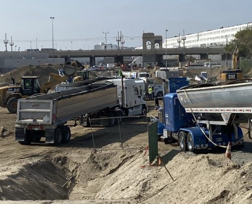
Division 20 Turnback – Los Angeles. CA
Railroad ProjectsSouthern California Office:
P: 949-542-4330
F: 949-542-4331
33161 Camino Capistrano Suite E
San Juan Capistrano, CA 92675
Northern California Office:
P: 650-368-1017
F: 415-381-5816
227 Tewksbury Avenue, Suite A1
Point Richmond, CA 94801
Contact Information:
Phone : 949-542-4330
Email: info@summitenvcon.com

